Quest CTD Data
Description of CTD Data by Paul Hines
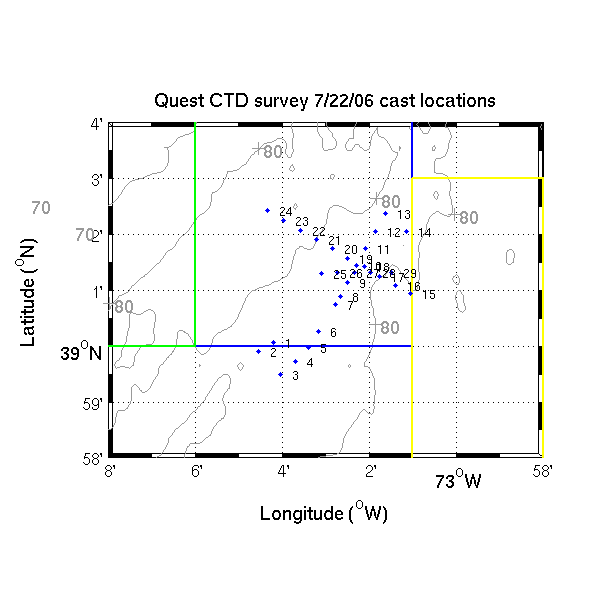
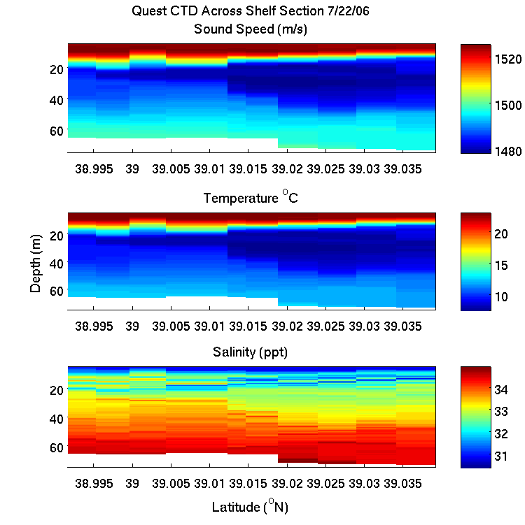
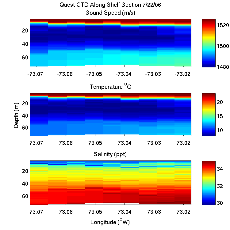
This is your Sunday update. I've included a comma delimited text file (saved from an Excel file) that Sean Pecknold put together. It is a string of CTD casts that we did on Friday evening using the moving vessel profiler. Also attached is a 2nd text file containing a short description of the row/column structure. The lat/longs and the times of the casts are also in the header. Hopefully this will help with your planning.
We did an FFCPt run last night on a North East track from 39deg 0.9954'N, 73deg 1.130' W to 39deg 1.9964'N, 73deg 3.3526'W and most of the route was very hard sand (penetration depths of about 10 cm and pull out loads of 900 Newtons.) Along the track at about 39deg 1.599'N, 73deg 2.526'W there seems to be a thin mud layer on the order of a couple hundred meters across. In that area the penetration depth is deeper (30 cm) and the pull out load was more like 3300 N. We have swathed an area nearly 2 km on a side that is centered on 39deg 1.47' N, 73deg 2.26' W.
This afternoon we did a WARBL (bottom loss measurement) run in the vicinity of this mud region and we just launched the WBS (approx. 39deg 1.599'N, 73deg 2.526'W) and plan to measure scatter toward and away from the mud along the track line of the FFCPT.
We're getting a bit tired after a string of 14 hour days but I thankfully I'm on a Canadian research vessel meaning that I just had a nice glass of cabernet with supper:-)
Cheers,
Paul
Map of CTD casts:

CTD Sections:


CTD data from the CFAV Quest
Back to the
WHOI SW06 home


